Map - Victoria, Chile (Victoria)

Victoria (Victoria)
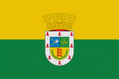
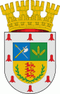
Victoria is a city and commune in Malleco Province of La Araucanía Region, Chile. It is the second most populous city in the Malleco Province, and is the gateway to the area known as Araucanía Andina, with attractions such as the Tolhuaca National Park, the Tolhuaca Hot Springs, Malalcahuello National Reserve, and the communes of Curacautín and Lonquimay. The climate is influenced by the vicinity of the temperate rainforest in Chile.

Victoria was founded in 1881 by Bernardo Muñoz Vargas by order of General Gregorio Urrutia, on a plateau overlooking the Traiguén River valley.

 
Map - Victoria (Victoria)
Map
Google Earth - Map - Victoria, Chile
Google Earth
Openstreetmap - Map - Victoria, Chile
Openstreetmap
Map - Victoria - Esri.WorldImagery
Esri.WorldImagery
Map - Victoria - Esri.WorldStreetMap
Esri.WorldStreetMap
Map - Victoria - OpenStreetMap.Mapnik
OpenStreetMap.Mapnik
Map - Victoria - OpenStreetMap.HOT
OpenStreetMap.HOT
Map - Victoria - CartoDB.Positron
CartoDB.Positron
Map - Victoria - CartoDB.Voyager
CartoDB.Voyager
Map - Victoria - OpenMapSurfer.Roads
OpenMapSurfer.Roads
Map - Victoria - Esri.WorldTopoMap
Esri.WorldTopoMap
Map - Victoria - Stamen.TonerLite
Stamen.TonerLite
Country - Chile
Currency / Language  
ISO Currency Symbol Significant figures
CLP Chilean peso $ 0
CLF Unidad de Fomento 4
ISO Language
ES Spanish language
Neighbourhood - Country  
  •  Argentina 
  •  Bolivia 
  •  Peru